What is base flood elevation?
Base flood elevation, or BFE, is the height of floodwater in a flood that has a 1 percent chance of happening in any given year. FEMA defines it as “the elevation of surface water resulting from a flood that has a 1% chance of equaling or exceeding that level in any given year.”
Think of it as a line on a vertical ruler. Floodwater at that line is not a guess about the next storm. It is a planning height that the federal flood maps use for a lot.
FEMA says any place with a 1 percent or higher yearly chance of flooding is “high risk.” It adds that those areas have at least a one-in-four chance of flooding during a 30-year mortgage. The 1 percent figure is the same one behind the BFE.
The BFE is expressed as an elevation above a fixed reference, not as a depth above your lawn. A lot could sit at 6 feet on the survey and have a BFE of 11 feet. The gap between the two is what a designer has to solve.
The BFE appears on the flood insurance rate map, often called the FIRM. It is shown for zones such as AE and VE. FEMA’s glossary also lists AH, AR and the older A1 to A30 and V1 to V30 labels. Not every zone has a BFE. A plain Zone X lot has none.
The base flood elevation matters most when a lot sits inside a Special Flood Hazard Area, or SFHA. That is the area where floodplain rules are enforced and where insurance is mandatory for many loans. Our flood zone building overview shows how the pieces fit.
Where do I find the BFE for my lot?
You can find the BFE for your lot from three official places: the City of Tampa, Hillsborough County and FEMA. Check all three if the lot sits near a city line or a map edge.
| Source | What it gives you | How to use it |
|---|---|---|
| City of Tampa Stormwater | The FIRM zone and the BFE or depth for a site, plus elevation certificates on file | Call (813) 274-3101 with the street address. The City says there is no charge. |
| Hillsborough County | The County Flood Zone Viewer | Search the parcel. County rules apply in unincorporated areas. |
| FEMA Flood Map Service Center | The official FIRM panels | Search the address on the Map Service Center. |
The City of Tampa page says it will provide the FIRM zone, the BFE or depth, and elevation certificates for new and substantially improved structures in the SFHA. The office asks for a street address. It also asks for the subdivision, lot and block number if you have them. The page lists hours of 8:00 am to 5:00 pm, Monday through Friday.
The City also keeps maps that show flood-hazard areas and areas of localized flooding. The City says those local maps may show problems that FEMA maps do not. It suggests checking them before you buy property.
FEMA calls its Flood Map Service Center “the official online location” for flood hazard mapping products created under the National Flood Insurance Program. If the City, the County and FEMA ever seem to disagree, ask the City which map governs your permit.
Hillsborough County tells applicants to verify the zoning district, flood hazard areas and BFEs on its Flood Zone Viewer and on the FEMA Map Service Center. That County page is a permit checklist for the County. The City of Tampa runs its own permits inside city limits.
What is freeboard and what does Tampa require?
Freeboard is extra height built above the BFE as a safety margin. A 2021 City of Tampa homeowner manual defines freeboard as “an added factor of safety ranging up to 4 feet above the BFE.”
That same 2021 manual says the Florida Building Code calls for the lowest floor to be at or above the BFE plus 1 foot, or the specified design flood elevation by jurisdiction, whichever is higher. The manual cites City of Tampa 2020 and Florida Building Commission 2017 sources for that statement.
Read that carefully. It is a 2021 document that repeats older sources. The City pages reviewed for this guide do not state a current freeboard number for a new house in Tampa. So this guide does not give you a current number. Ask Tampa Construction Services at (813) 274-3100, option 1, what applies to your permit today.
Two points are safe to take from the manual. First, freeboard is a margin, not a fixed number for every lot. Second, when two heights apply, the higher one wins.
The manual also describes policy options a city could adopt, such as 2 feet of freeboard in areas exposed to sea level rise. Those are options in a planning document. They are not a statement that Tampa requires 2 feet.
Hillsborough County takes a “most restrictive shall apply” approach. Its page says properties in the SFHA must comply with the County construction code, the County Land Development Code, ASCE 24, the Florida Building Code and other laws, and that the most restrictive applies. The County page is for the unincorporated County. It does not set the rule inside City of Tampa limits.
How do BFE and design flood elevation differ?
BFE comes from the flood map. Design flood elevation, or DFE, is the level a local government adopts as the building target. The DFE can equal the BFE or sit above it.
The 2021 City manual says DFE is typically the elevation at the top of freeboard, above the BFE. In plain terms, BFE plus freeboard gives a DFE.
The manual adds a second case. If a map shows no BFE, the Florida Building Code gives the building official authority to require the applicant to use data from another source or to set the DFE by accepted engineering practice. A lot with no printed BFE does not mean a lot with no flood rule.
Hillsborough County code defines design flood elevation as the elevation of the “design flood,” including wave height, relative to the datum on the flood hazard map. For Zone AO, it says the DFE is the highest existing grade at the building’s edge plus the depth number on the map. If the map gives no depth number, the County code uses 2 feet. That is a County definition. Use it only to understand the idea.
| Term | Where it comes from | What it tells you |
|---|---|---|
| Base flood elevation | FEMA flood map | The 1 percent chance flood level |
| Freeboard | Code or local adoption | Extra height above the BFE |
| Design flood elevation | The local government | The level the lowest floor must meet |
| Finished floor or lowest floor | Your plans and later your survey | Where the house actually sits |
The 2021 manual also uses the term “finished flood elevation,” or lowest floor elevation, for the lowest enclosed or enclosable area. It warns that an existing house whose lowest floor sits below the DFE may face higher insurance premiums.
How does BFE change the design of a house?
BFE changes the design because the lowest floor must clear a set height. That height drives the stairs, the foundation type, the ceiling heights and the overall roofline.
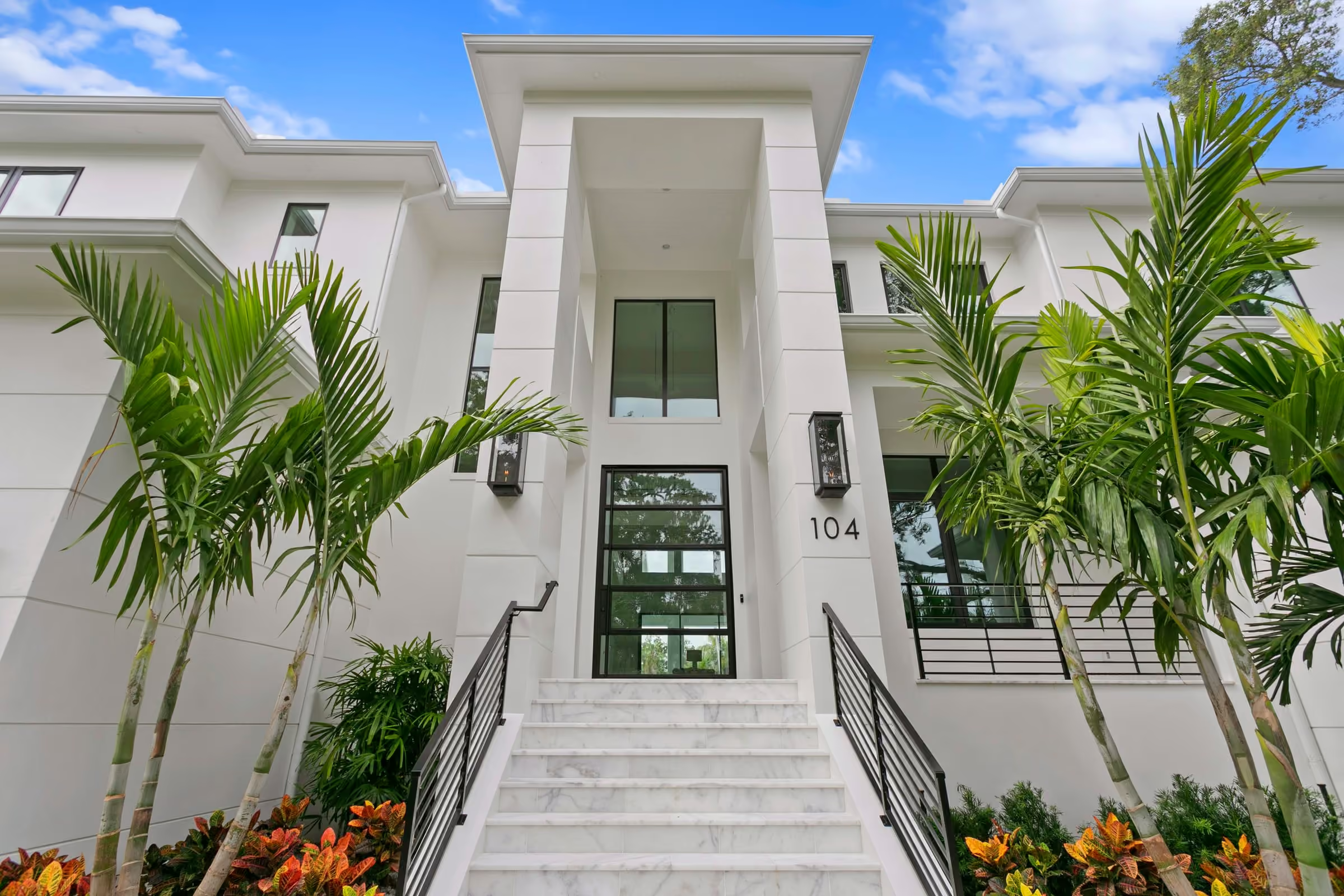
A higher floor means more steps from the street. It also means a taller foundation wall or a raised slab. The designer then has to keep the finished house within the zoning height limit, which is a separate rule. The Tampa homeowner manual notes that residential neighborhoods typically carry a 35-foot maximum height. Check your district before you assume it.
Space below the flood elevation has strict limits. Hillsborough County’s checklist says enclosed areas below the BFE, including crawlspaces, may be used solely for parking, building access or storage. It requires openings that let floodwater enter and leave, so water pressure stays equal on both sides of the wall. It also requires a nonconversion affidavit signed by the owner. These are County permit rules. Ask the City which rules apply inside Tampa.
Here are the design choices that move with the elevation:
- Foundation type, such as a raised slab, stem wall or piers.
- Garage and ground-level storage, since those are usually the spaces allowed below the flood elevation.
- Mechanical equipment placement, since the manual describes elevating utilities.
- Stair runs, porches and the entry sequence.
- Exterior grading and drainage around the house.
A good design starts with the elevation, not with the floor plan. The Visualize step of the Halo Homes process, which comes before Design and Build, is a natural place to bring the flood numbers into the conversation. The lot’s elevation is a fact of the site, the same as its width.
If you are weighing a build, our custom home construction page explains how Halo Homes approaches the work. Halo does not publish prices or timelines, so ask for them in a direct conversation.
What changes when FEMA updates maps?
When FEMA updates a flood map, the zone or the BFE for a lot can change. Flood maps are not fixed for all time.
FEMA says flood risk is always changing. It describes map updates as a joint effort between a community and FEMA. FEMA works with local engineers and surveyors to collect data, and community members can offer information about how water drains in the area.
FEMA lists these steps in the process:
- Preliminary flood maps become available for review.
- Before a community adopts the maps, there are 90 days to submit technical data to support an appeal.
- After adoption, owners can submit data to amend or revise the map through the Letter of Map Change process.
For a buyer or builder, the lesson is timing. A map in force when you buy a lot may not be the map in force when you apply for a permit. Ask the City whether a map change is under way for your area.
The City of Tampa flood page makes a related point. It says “just because you haven’t experienced a flood in the past” does not mean you won’t in the future, and that flood risk rests on rainfall, river flow, tidal surge data, topography, flood-control measures and changes due to building and development.
Insurance also depends on the map. The City says Tampa is rated Class 5 in the Community Rating System, which gives a 25 percent discount on flood insurance premiums in flood zones and a 10 percent discount outside them. That is a City statement about the community rating. Your own premium depends on your policy, and the City says homeowner policies usually do not cover flood damage.
What should I ask the City?
Ask short, specific questions and write down the answers with the date, the name of the person who answered and the address you asked about. Print the list below and bring it to the first call.
What to ask the City
- What FIRM zone is my address in, and what is the BFE or depth shown for it?
- Is a map change under way for this area?
- What freeboard or design flood elevation applies to a new house at this address today?
- Is the lot on the Stormwater Advisory List of flood-prone properties?
- What does the permit application need, and does it need an elevation certificate with the drawings?
- Who completes the elevation certificate? (The City page says a Professional Engineer or a Professional Land Surveyor.)
The City says to check with its Construction Services Center before grading, filling or building on your property. Call (813) 274-3100 for Construction Services. The City notes that planned changes may need permits so your project does not cause problems for neighbors.
The City also keeps a “Stormwater Advisory List” of flood-prone properties and says development in those areas might be restricted. That is a separate check from the FIRM zone.
For the full path after you have the number, read our guide on elevation certificates for new construction. If you are repairing or enlarging an older house, read the FEMA 50 percent rule guide too.
What is the next step?
Get the BFE and the current freeboard rule for your address from the City, then bring those numbers to a design conversation. A lot with a high BFE is not a dead end, but it changes the plan. To talk through a lot with Halo Homes, contact the team or call (813) 956-1972.
Facts checked October 2026 against the sources listed on this page.
Frequently asked questions
What is base flood elevation in Tampa?
Base flood elevation is the elevation of surface water in a flood that has a 1 percent chance of equaling or exceeding that level in any year. FEMA shows it on the flood map for zones such as AE and VE. The City of Tampa will look up your address for free at (813) 274-3101.
What is freeboard?
Freeboard is extra height added above the base flood elevation as a safety margin. A 2021 City of Tampa homeowner manual says it can range up to 4 feet above the BFE. The height your lot needs depends on the rules in force today, so confirm with the City.
How high must a new house be above the BFE in Tampa?
A 2021 City of Tampa manual says the Florida Building Code calls for the lowest floor to be at or above the BFE plus 1 foot, or the local design flood elevation, whichever is higher. That document is dated 2021. Ask Tampa Construction Services for the figure that applies today.
Is design flood elevation the same as base flood elevation?
No. Base flood elevation comes from the flood map. Design flood elevation is the level a local government adopts for building, and it can sit above the BFE when freeboard is added. Hillsborough County code also counts wave height in the design flood for coastal areas.
Can a flood map change after I buy a lot?
Yes. FEMA says flood risk is always changing and that maps are updated through a process shared with local communities. After a community adopts new maps, owners can also ask for a map change. Check the Flood Map Service Center before you buy and again before you design.
Terms on this page
Sources
- FEMA: Base Flood Elevation (BFE)
- FEMA: Flood Maps
- City of Tampa: Flooding
- City of Tampa: A Homeowner's Best Practices Manual (2021)
- Hillsborough County: Special Flood Hazard Area Requirements
Written for Halo Homes and checked against the sources above on October 29, 2026. City, county and code rules change, so check the linked page before you act.